
Iziko_SAMLB_D_!n007
Metadata
Iziko_SAMLB_D_!n007
Drawings, Watercolours, Things
ǃnanni
image
pencil
15 September 1881
315x254
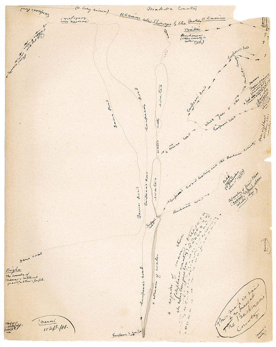
This map is said to represent the Bushmen's country, !nanni's country, a region of many thorn trees (elephant country) also Naba trees grow here, sunrise, a country of fruit trees (!naxane, |kui, shao, tshaka, dui), Bushman road, tcho (this is a place where there is a water pit), European's road leading into the Bushman country, more elephant and thorn-tree country, water, a mere road, which goes to the Makoba country, European's road, !kanni ǂnauwa (a water-pit), a pool called ||gu |ne seems to be near it, |kau sha (also a place where water is), European's road, xamma (much water), water, water, water, water, |ya-kao Bushmen (their country is called |ya), Makoba country, a long river, ||xumm called Shonongo by the Makoba, ||xumm, European's road, Dama road, Here the two roads join, European's road, Damara Road of return to their own country, European's road, European's road, a stream of water, Bezha, The country of !nanni's maternal grandfather's people, Dama road
personal history
relations with others
plants and animals
custom and daily life
map (!nanni's maternal grandfather's people), map (!nanni's country), map (!kun country), plant (in map of !nanni's country), plant (fruit and thorn trees), animal (elephant), animal (in map of !nanni's country), European (road), European (and map of !nanni's country), Bushmen (|ya-kao), Bushmen (their country), Bushmen (and map of !nanni's country), personal history (map of his country), water ('much'), water (-place), water (-pool), water (-pit), water (and map of !nanni's country), road (European's), road (Damara), road (and map of !nanni's country), Makoba (country), Makoba (and map of !nanni's country), Damara (road), Damara (and map of !nanni's country), Ovaherero (Dama road), Ovaherero (and map of !nanni's country)
Contributions